
Invasive species are non-native plants, animals and insects that harm native species, ecosystems, native people’s cultural resources, and industries such as agriculture, forestry, and hydropower. Expansions of global trade and an increase in human mobility have resulted in unprecedented invasion by invasive species. These species threaten biodiversity, habitat quality, and ecosystem function and are believed to have contributed to the decline of 42% of the endangered and threatened species in the United States. In Washington State, the cost of dealing with invasive species runs into millions of dollars each year.
Managing invasive species here in Washington State is complex due to the number and types of pathways through which species are introduced. A number of local, state and federal agencies and organizations work to prevent the introduction and spread of invasive species, physically control or eradicate them, monitor their distribution, and understand their characteristics. With this app, the public can help to identify and report invasive species before they become a bigger problem. The goal of this mobile app is to make species identification easier and help improve detection and reporting of harmful invasive species statewide.
Managing invasive species here in Washington State is complex due to the number and types of pathways through which species are introduced. A number of local, state and federal agencies and organizations work to prevent the introduction and spread of invasive species, physically control or eradicate them, monitor their distribution, and understand their characteristics. With this app, the public can help to identify and report invasive species before they become a bigger problem. The goal of this mobile app is to make species identification easier and help improve detection and reporting of harmful invasive species statewide.
My Role:
I worked closely with our developer and project manager to create an easy-to-use interface that will allow the user to effortlessly help capture data about invasive species in Washington State.
I worked closely with our developer and project manager to create an easy-to-use interface that will allow the user to effortlessly help capture data about invasive species in Washington State.
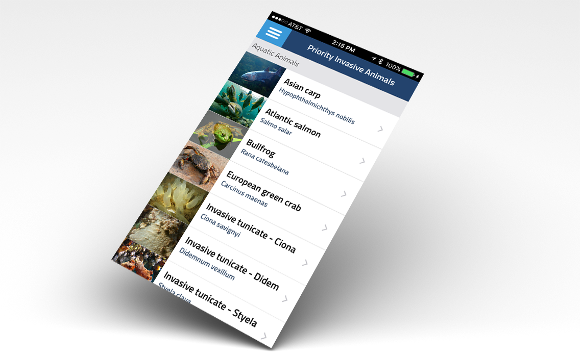
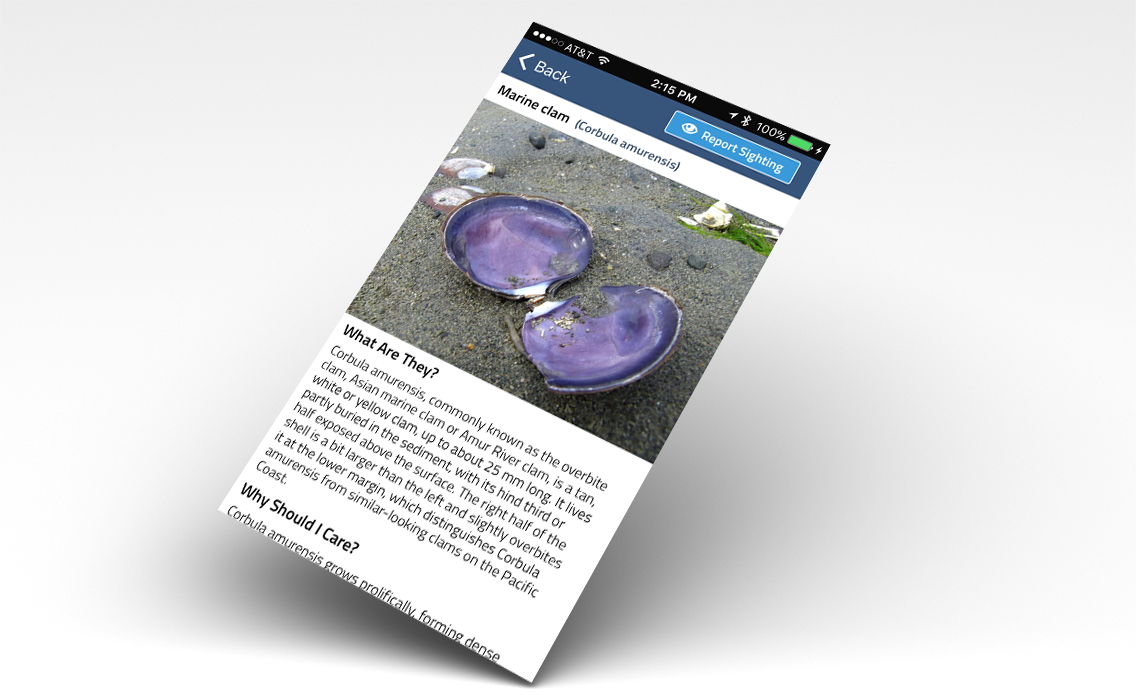
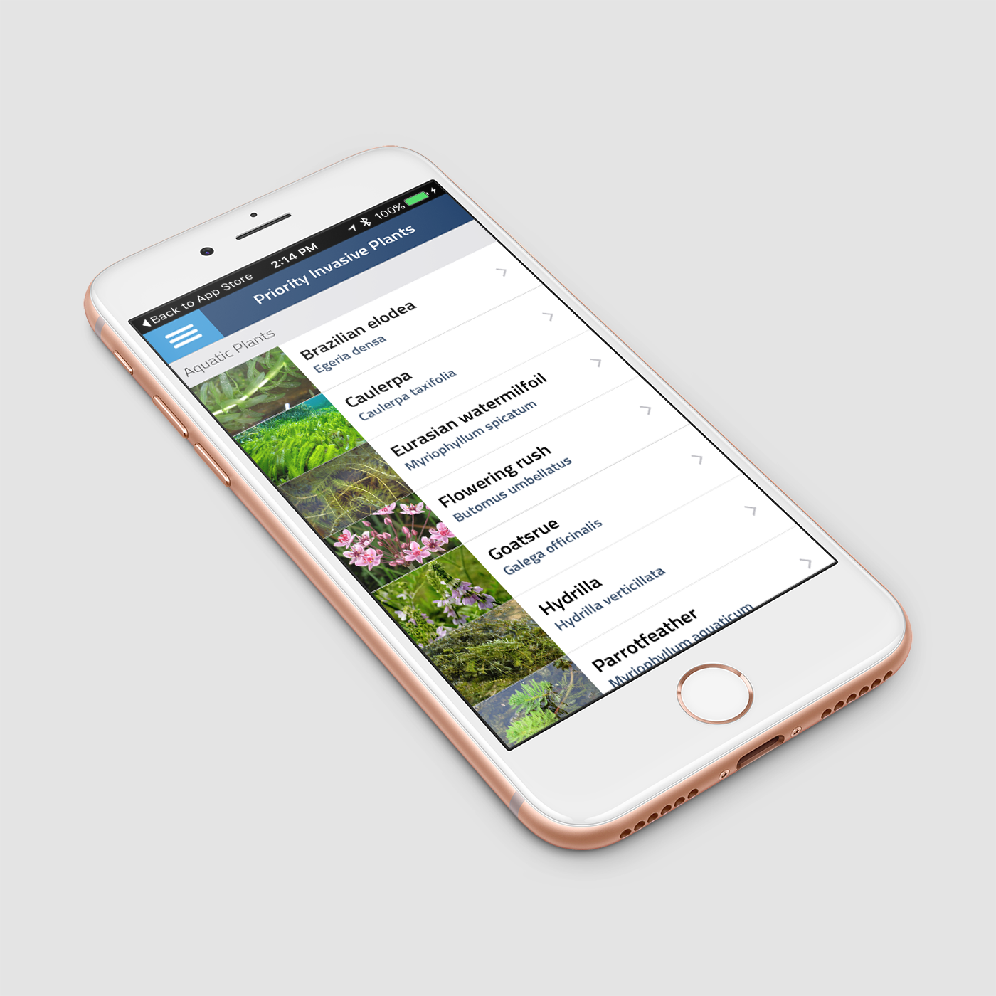
User can also learn more about priority invasive species in Washington with easy-to-understand descriptions and images.
Crowdsourcing is a popular method for gathering information, everything from restaurant ratings to micro-local weather conditions. This mobile application leverages crowdsourcing functionality to help combat invasive plant and animal species in Washington State. The Washington Invasive Species Council (WISC) application – sponsored by the Washington State Recreation and Conservation Office (RCO) – allows users to submit sighting reports from their iPhone or Android device, when and where they locate them. Descriptions and photos of priority invasive species are included to help users identify harmful species. If a user is offline, a report can be saved to their phone until they have a network connection. A companion web application is used by WISC staff and local experts to review and approve sighting reports.
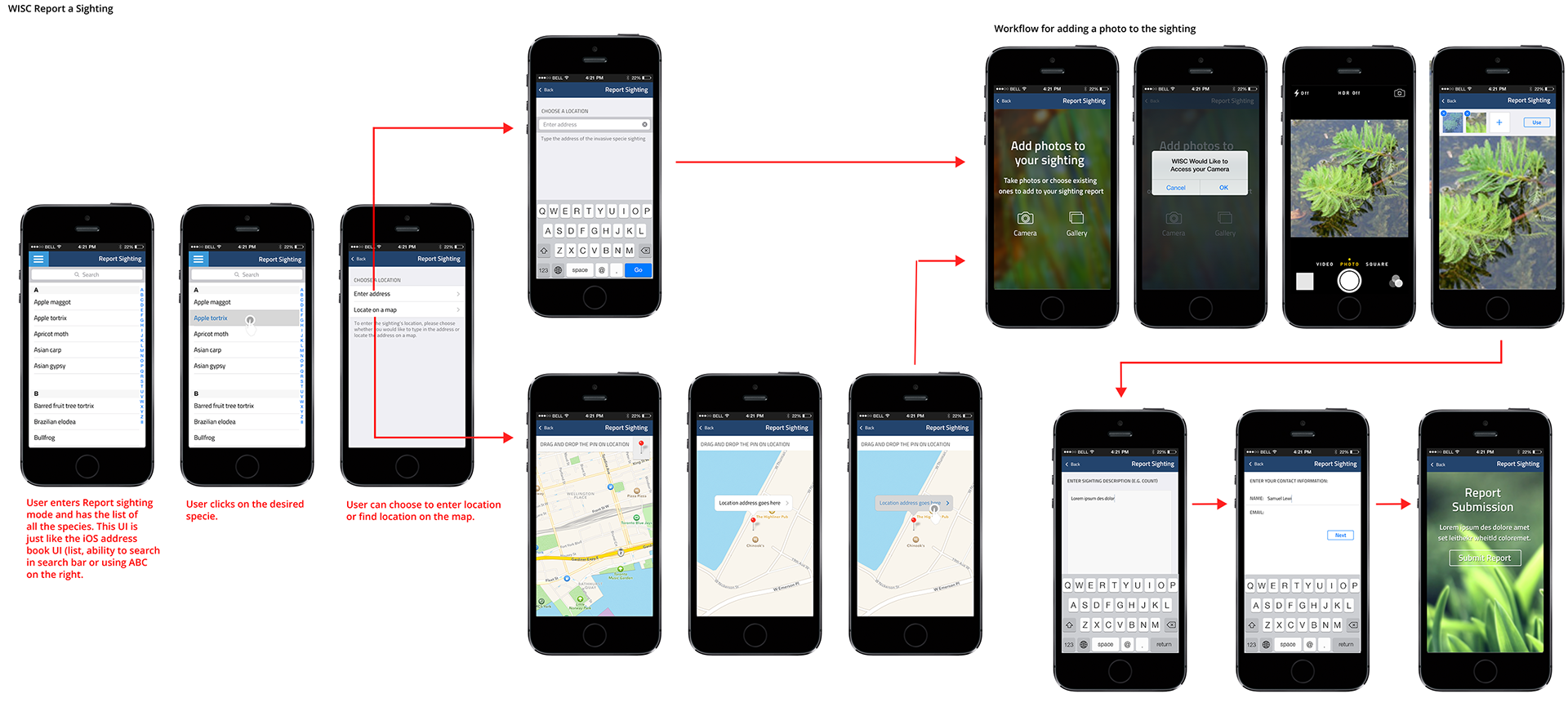
workflow of the native app
Users can filter the type of financial institutions they want to view on the map and at the same time turn on contextual layers such as mobile coverage and population density to help understand the landscape of banking access to the poor in the country.
Some of the features included in the app:
- GPS and Photo Tools Easy species reporting uses your GPS to capture your current location and an image of your sightings.
- GPS and Photo Tools Easy species reporting uses your GPS to capture your current location and an image of your sightings.
- Offline Caching Report sightings that can be saved on your phone for uploading when you have network connectivity.
- Easy-to-Learn Species Info Images and information on Washington Invasive Species Council’s priority plant and animal species.
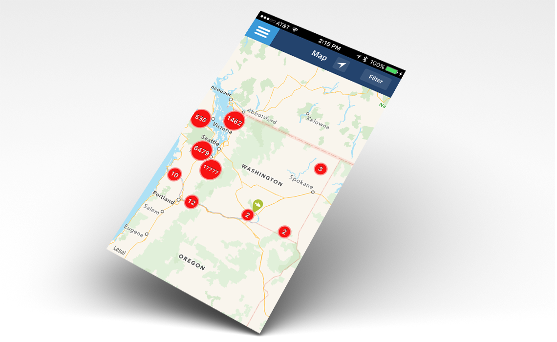
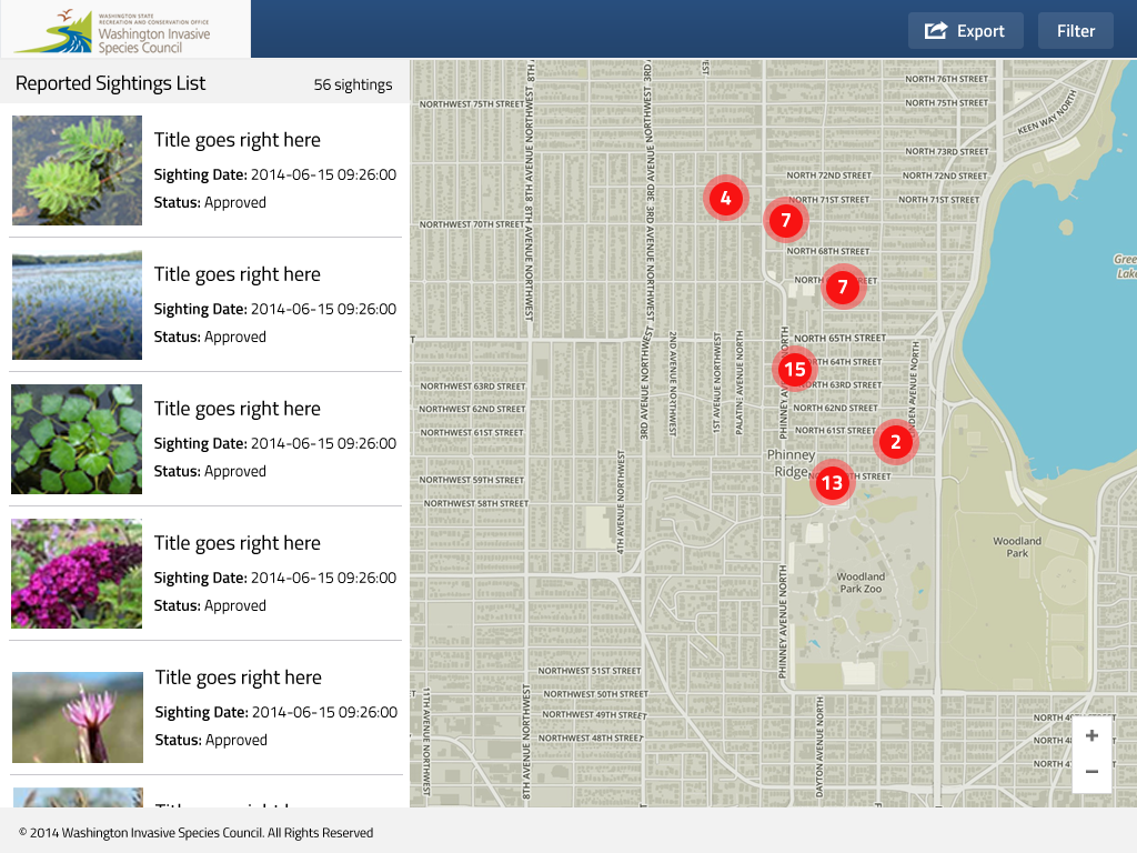
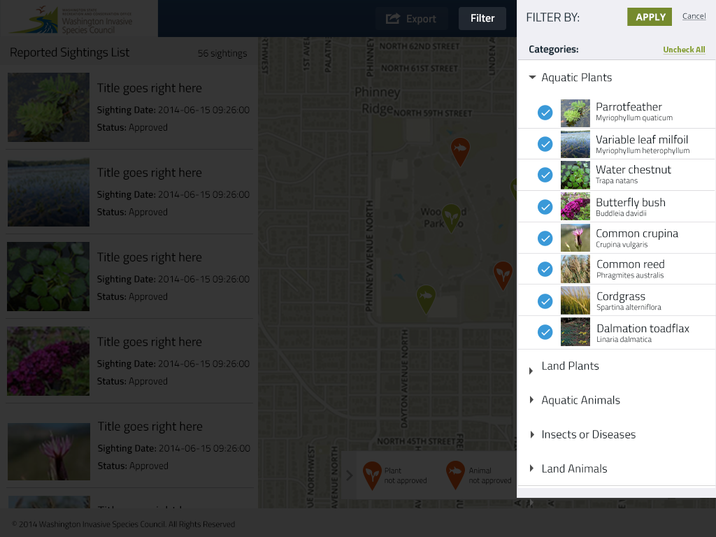
- View other sighting reports dynamic distribution maps showing confirmed sightings of all species captured through the app from user’s current location.
This app is part of an integrated invasive species reporting and outreach campaign for WISC that also includes a website with an online reporting form. User can submit invasive species sighting reports directly with their mobile device where they occur. These sighting reports are submitted to Washington Invasive Species Council (WISC) staff and technical experts throughout the state to review and approve sighting reports. Sightings that are approved will be viewable directly through the app’s mapping tool.
The mobile app is part of an integrated WISC invasive species reporting and outreach campaign that also includes a website with an online reporting form and a hotline for immediate reports of sightings.
The travel time walkshed tool allows the user to drop a pin on the map to see how long a person needs to travel (by foot, by car or by bike) to access a financial institution. User can choose the travel time they want to view.